3.4.4.2. Image conversion
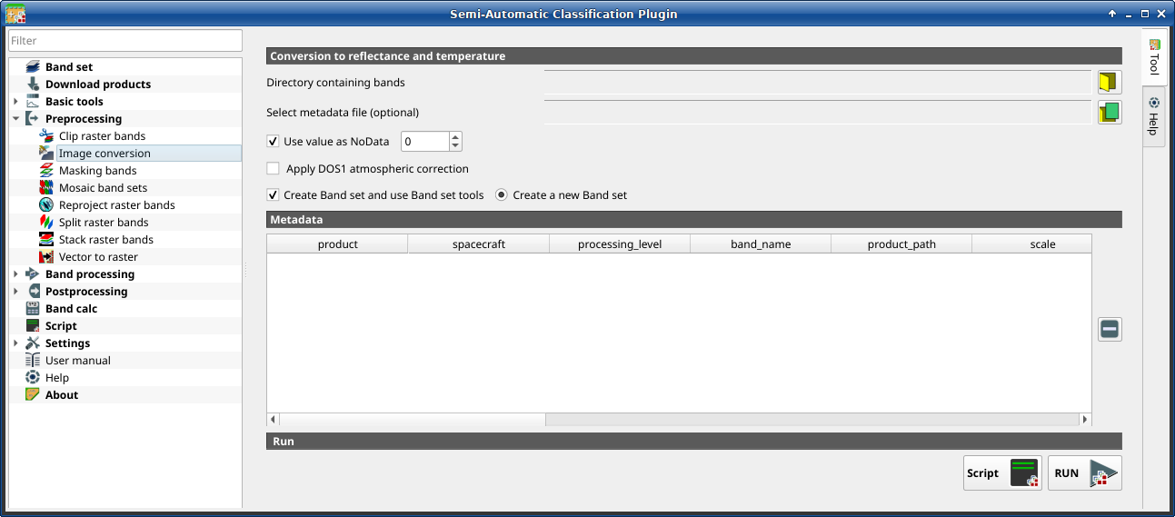
Image conversion
This tool allows for the conversion of several products to reflectance. Depending on the processing level of the source product, the conversion can be to the physical measure of Top Of Atmosphere reflectance (TOA), or the application of a simple atmospheric correction using the DOS1 method (Dark Object Subtraction 1), which is an image-based technique (for more information about conversion to TOA and DOS1 correction, see Image conversion to reflectance). In case the source product is already provided as surface reflectance level, the rescaling factors are applied to convert the DN to decimal values.
The following products can be processed:
Sentinel-2 images Level-1C;
Sentinel-2 images Level-2A;
Landsat 1, 2, 3 MSS, 4, 5, 7, 8, 9 images Collection 2 Level-2;
Harmonized Landsat Sentinel-2.
Tip
Information about APIs of this tool in Remotior Sensus at this link .
3.4.4.2.1. Image conversion
Once the input is selected, available bands are listed in the metadata table.
Tool symbol and name |
Description |
|---|---|
Directory containing bands |
open a directory containing product bands; names of bands must end with the corresponding number; if the metadata file is included in this directory then Metadata is automatically filled |
Select metadata file |
select the metadata file if not included in the
Directory containing bands; for Sentinel-2, the metadata
file is a .xml file whose name contains |
|
if checked, pixels having |
|
if checked, the DOS1 Correction is applied to all the bands |
|
if checked, bands are added to the active Band set after the conversion; also, the Band set is processed according to the tools checked in the Band set (complete interface) |
|
if checked, bands are added to a new empty Band set after the conversion |


Tip
For the best spectral precision one should download Surface Reflectance products (e.g., for Sentinel-2 the Level-2A Products).
Warning
For Sentinel-2 L2A images downloaded as .zip file, all the .jp2 files must be moved inside the same directory and renamed according to the band number in the ending (e.g. from name_02_10m.jp2 to name_02.jp2).
3.4.4.2.2. Metadata
Metadata are required for the process to identify the product. If the Metadata file is not inside the input directory, one can define the file path in Select metadata file. In the Metadata, all the bands found in are listed.
The table Metadata contains the following fields.
product |
spacecraft |
processing_level |
band_name |
product_path |
scale |
offset |
nodata |
date |
k1 |
k2 |
band_number |
e_sun |
earth_sun_distance |
|---|---|---|---|---|---|---|---|---|---|---|---|---|---|
product name (e.g., Sentinel-2) |
spacecraft name (e.g., Sentinel-2) |
processing level of the product (e.g., Level-2) |
name of the band |
path of the band |
scale of the band |
offset of the band |
nodata value of the band |
date of acquisition of the product |
k1 parameter for Landsat thermal conversion |
k2 parameter for Landsat thermal conversion |
band number |
solar irradiance of band |
Earth-Sun distance |
It is possible to remove bands from the table, to exclude these bands from the conversion.
Tool symbol and name |
Description |
|---|---|
|
remove highlighted bands from the table Metadata |

Bands having different spatial resolution are not resampled at this stage. However, when using these bands in a classification process, all the bands are resampled on the fly to the highest spatial resolution with nearest neighbor.
Tool symbol and name |
Description |
|---|---|
Script |
add this function to the Script (complete interface) |
RUN |
run this function |


Tip
To reduce file size, output files are saved as data type UInt16 with scale 0.0001, which are interpreted as Float32 type by GDAL.